Executive Summary
Fatepura is a village in the Satlasana Taluka of Mehsana district, Gujarat. This guide provides information for property buyers and land investors. Fatepura has a population of 1,239, according to the 2011 Census. The village is primarily agricultural, with 75.7% of the workforce engaged in agriculture. The literacy rate is 67.6%. Investing in Fatepura requires careful consideration of land records and local regulations.
The village's location, 40 km from the nearest town of Kheralu and 62 km from the district headquarters of Mahesana, influences its development. The primary school offers basic education, and mobile coverage and bus service connect the village to other areas. Land prices may be affected by agricultural dependency. Potential investors should research the area's strengths and weaknesses.
This guide will explain the local geography, demographics, infrastructure, land record verification, economic drivers, investment potential, and strategic considerations for Fatepura. It will provide crucial insights for making informed decisions.
Location and Geography
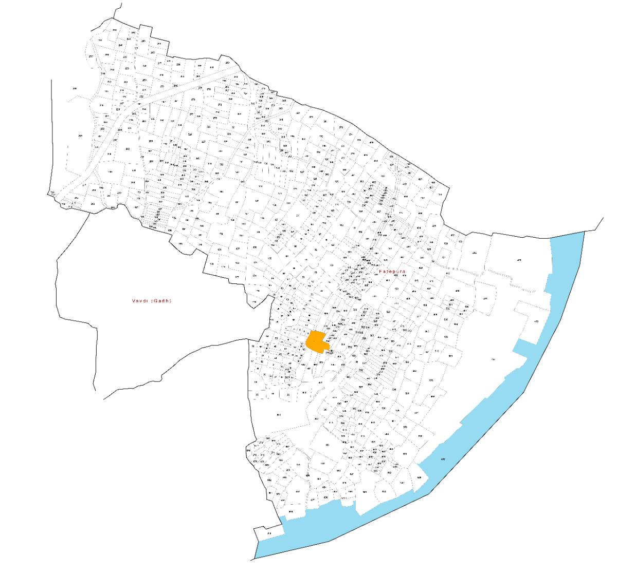
Fatepura is located in the Satlasana Taluka of the Mehsana district in Gujarat. The total geographical area of the village is 484.9 hectares. This translates to a population density of 2.6 persons per hectare. Understanding the geography of Fatepura is important for land investment.
The terrain of the area is generally flat, typical of the North Gujarat plains. The soil type is mostly alluvial, which is suitable for agriculture. This supports the large agricultural sector in the village. Alluvial soil is known for its fertility and water retention. This contributes to the area's agricultural productivity.

Water resources in Fatepura are crucial for its agricultural activities. The village likely relies on a combination of groundwater and canal irrigation. The availability of water affects crop yields and land value. Further investigation into local irrigation systems and water management practices is advisable. The nearest town, Kheralu, is 40 km away. The district headquarters, Mahesana, is 62 km away. These distances impact access to markets, services, and administrative functions. Precise coordinates for Fatepura village are not provided in the available data. However, these can be obtained from the local land revenue office.
The physical geography influences the types of crops that can be grown. It also affects the feasibility of different types of development. Investors should assess the sustainability of water resources. They should understand the potential impact of environmental factors. The PM Gati Shakti National Master Plan is a digital platform that may provide some relevant geospatial data to understand regional connectivity improvements. https://pmgatishakti.gov.in/
Socio-Demographics
Fatepura has a population of 1,239 people, according to the 2011 Census. The male population is 643, and the female population is 596. This data gives us a sex ratio of 927 females per 1,000 males. There are 241 households in the village. These demographic figures are essential for understanding the social structure.
The literacy rate in Fatepura is 67.6%. This indicates the proportion of the population that can read and write. Education levels affect the availability of skilled labor. They also influence the overall development of the village. Improving the literacy rate is vital for future progress.
The worker participation rate is 53.8%. This represents the percentage of the population engaged in economic activities. A significant portion of the workforce, 75.7%, is dependent on agriculture. This indicates the importance of farming to the local economy. The total number of workers is 666. Main cultivators account for 321, and agricultural laborers number 183. The available data does not provide details on other types of employment.
Understanding the age distribution and social groups within the village would require further investigation. However, these basic demographic indicators provide a starting point. They can help investors assess the potential of the area. They can also understand the challenges that it faces. These numbers are critical for planning any development projects. They help to ensure projects align with the needs of the local population.
Planning and Governance
Information on specific FSI/FAR rules, land use zoning, and NA conversion processes for Fatepura is not available in the provided census data. These aspects are determined by the local governing bodies and the Gujarat state government. Potential investors need to consult the relevant authorities for detailed regulations. These regulations dictate the permissible construction on a plot of land.
Land use zoning defines how land can be used. This includes residential, commercial, agricultural, and industrial purposes. Understanding the zoning regulations is crucial before investing in land. Unauthorized use of land can lead to legal issues.
The NA (Non Agricultural) conversion process is necessary when converting agricultural land for non agricultural purposes. This process involves obtaining permission from the relevant authorities. The Gujarat government has specific procedures and guidelines for NA conversion. The Ministry of Housing and Urban Affairs provides information on urban and regional planning schemes that might be relevant. https://mohua.gov.in/
It is important to determine if Fatepura is covered by any regional Master Plan. A Master Plan outlines the long term development goals for an area. It includes provisions for infrastructure development, land use, and environmental protection. Investors should check if their investment plans align with the Master Plan. Information regarding local governance and development plans can be obtained from the Gram Panchayat office in Fatepura. This office is responsible for implementing government schemes. It also manages local affairs.
Understanding the local governance structure and planning regulations supports any land investment. This will help investors avoid legal problems. It ensures that their projects are in line with the overall development strategy. NITI Aayog's website provides resources on best practices in rural development and governance. https://niti.gov.in/
Physical Infrastructure
Fatepura has mobile coverage and bus service connectivity. This is according to the 2011 Census. This indicates basic access to transportation and communication. Reliable connectivity is vital for economic activity. It also facilitates access to services. Details on the frequency and quality of bus services are not available.
Specific information on power supply and water supply infrastructure is not provided in the census data. It is likely that the village is connected to the state electricity grid. Water supply may be through a combination of groundwater sources. Water may also come from surface water schemes. The quality and reliability of these services can significantly impact the quality of life. They also impact business operations.
Road connectivity details are not available. The fact that there is a bus service indicates that the village is accessible by road. However, the condition and type of roads connecting Fatepura to nearby towns and cities would need to be investigated. Good road connectivity is needed for transporting goods and people. It enables access to markets and employment opportunities.
Telecom coverage, beyond mobile connectivity, is not specified. This includes internet access and landline availability. These factors are important for businesses and residents. Access to reliable communication infrastructure can improve access to information. It also facilitates economic development. The Digital India program focuses on improving digital infrastructure in rural areas. https://www.digitalindia.gov.in/
Investors should assess the adequacy and reliability of the existing physical infrastructure. This is important before making any investment decisions. Improvements in infrastructure can significantly enhance the value of land and property. The PM Gati Shakti plan aims to improve infrastructure connectivity. This could benefit villages like Fatepura in the long term. https://pmgatishakti.gov.in/
Social Infrastructure
Fatepura has one school, which is a primary school. This is according to the 2011 Census. Access to education matters for the development of the village. The presence of a primary school indicates the availability of basic education for children. Information on the quality of education is not provided. Additional details like student teacher ratios would be useful.
The available data does not provide information on the availability of health facilities in Fatepura. It is not clear whether there is a local health center. The data doesn't say whether residents have to travel to nearby towns for medical care. Access to healthcare is necessary for the well being of the population.
Information on other local institutions, such as community centers, libraries, or vocational training centers, is not available. These institutions play a vital role in social development. They provide opportunities for learning, recreation, and community engagement.
The availability of social infrastructure impacts the quality of life and attractiveness of the village. Investors often consider these factors when evaluating potential investments. Improving access to education and healthcare can significantly enhance the value of land.
Land Records
Verifying land records is essential before investing in property in Fatepura, Gujarat. The process involves checking the ownership, encumbrances, and other details related to the land. The Digital India Land Records Modernization Programme (DILRMP) aims to digitize and modernize land records. This makes them more accessible and transparent. https://dolr.gov.in/
Here is a practical guide on how to verify land records:
Obtain Land Details: Collect the survey number, plot number, and village name. These details are needed to access the land records.
Access Gujarat Land Records Portal (e-Dhara): The Gujarat government provides an online portal for accessing land records. Search for Gujarat e Dhara to find the official website.
Search for Records: Use the land details to search for the relevant records on the portal. This includes:
- Record of Rights (ROR): Also known as 7/12 extract, this document provides information about the owner, land area, type of land, and any encumbrances.
- Village Form 6 (VF6): This is the register of mutations, showing changes in ownership or rights on the land.
Verify Ownership: Check the ROR to confirm the current owner of the land. Ensure that the name matches the seller's identity.
Check for Encumbrances: Look for any loans, mortgages, or legal disputes registered against the land on the ROR. This is crucial to avoid future legal issues.
Verify Mutation Records: Review the VF6 to understand the history of ownership transfers. This helps to identify any potential discrepancies or disputes in the title chain.
Physical Verification: Visit the land and verify the boundaries and physical condition of the property. This helps to confirm that the land matches the records.
Consult a Lawyer: It is advisable to consult a lawyer to review the land records. A lawyer can provide legal advice and help to identify any potential risks.
Obtain Certified Copies: Obtain certified copies of the land records from the Mamlatdar office or the local land revenue office. These copies are legally valid and can be used for official purposes.
Title Insurance: Consider purchasing title insurance to protect against any undiscovered defects in the title.
| Step | Description |
|---|---|
| Obtain Land Details | Collect survey number, plot number, village name |
| Access e Dhara Portal | Visit Gujarat's online land records portal |
| Search for Records | Find ROR (7/12) and VF6 using land details |
| Verify Ownership | Confirm the current owner of the land |
| Check for Encumbrances | Identify any loans or legal disputes on the land |
By following these steps, investors can minimize the risk of fraud and ensure a smooth land transaction.
Economic Engine
The local economy of Fatepura is primarily driven by agriculture. According to the 2011 Census, 75.7% of the workforce is engaged in agricultural activities. This highlights the importance of farming for the livelihoods of the residents. The total number of workers in the village is 666. Of these, 321 are main cultivators and 183 are agricultural laborers.
The main occupations in Fatepura revolve around crop cultivation and farm labor. The types of crops grown are not specified in the census data. However, given the alluvial soil, common crops in the region may include cereals, pulses, and vegetables. The success of the agricultural sector depends on factors such as rainfall, irrigation facilities, and access to markets.
Information on nearby industries is not provided in the census data. The nearest town, Kheralu (40 km away), likely serves as a local trading center. Mahesana (62 km away), being the district headquarters, would offer a wider range of economic opportunities.
Commuter patterns are not detailed in the census data. It is possible that some residents commute to Kheralu or Mahesana for work. This would depend on the availability of transportation. The presence of bus service suggests some level of connectivity.
Diversifying the local economy beyond agriculture is important for sustainable development. This could involve promoting small scale industries or encouraging skill development programs. The available data does not provide insights into local entrepreneurship or vocational training. However, these aspects are important for improving the economic prospects of the village.
Investment and ROI
Investing in land in Fatepura, Gujarat requires careful consideration of various factors. Land price trends in the area are not explicitly available in the provided census data. However, land prices are generally influenced by location, accessibility, irrigation facilities, and potential for development.
Given the agricultural dependency of the village, land prices may be relatively lower compared to more urbanized areas. However, improvements in infrastructure and connectivity could drive up land values. The potential for converting agricultural land for non agricultural purposes (NA conversion) can also impact prices.
The investment potential in Fatepura depends on the investor's goals and risk appetite. Opportunities may exist in:
Agricultural land: Investing in agricultural land can provide a steady income stream through crop cultivation. However, this is subject to the risks of weather and market fluctuations.
Residential plots: As the population grows, there may be demand for residential plots. However, the pace of urbanization in the village is uncertain.
Commercial properties: The potential for commercial development depends on the growth of the local economy and the demand for goods and services.
It is essential to conduct thorough due diligence before investing in land. This includes verifying land records, checking for encumbrances, and understanding local regulations. Consulting with local real estate agents and legal experts is highly recommended.
Disclaimer: Land investments are subject to market risks. Land prices can fluctuate based on economic conditions, government policies, and local developments. There is no guarantee of returns on investment. Investors should carefully assess their risk tolerance and conduct independent research before making any investment decisions.
The availability of infrastructure, such as roads, electricity, and water supply, can significantly impact the value of land. Government initiatives to improve rural infrastructure can create investment opportunities. Investors should monitor government policies and development plans. These can affect the investment potential of the area. Analyzing land records and local development plans is critical for assessing investment risks. It is crucial to understand the potential for appreciation of land value.
| Factor | Impact on Land Price |
|---|---|
| Location | Proximity to towns, connectivity |
| Infrastructure | Availability of roads, electricity, water |
| Land Use | Zoning regulations, potential for NA conversion |
| Economic Activity | Agricultural productivity, nearby industries |
| Government Policies | Rural development schemes, land acquisition laws |
Strategic Considerations
Fatepura's growth outlook is closely tied to the development of the surrounding region. The village's strengths and weaknesses need to be carefully analyzed. This will help in understanding its potential for future growth.
Strengths:
Agricultural Base: The strong agricultural base provides a foundation for economic activity. 75.7% of the workforce is engaged in agriculture.
Connectivity: The presence of mobile coverage and bus service connects the village to other areas.
Relatively Low Population Density: With a population density of 2.6 persons per hectare, there is potential for development without overcrowding.
Weaknesses:
Limited Literacy Rate: The literacy rate of 67.6% indicates a need for improvement in education.
Distance from Urban Centers: The distance of 40 km from Kheralu and 62 km from Mahesana limits access to markets and services.
Lack of Information on Infrastructure: Limited information on water supply, power supply, and road conditions makes it difficult to assess the quality of life.
Opportunities:
Infrastructure Development: Government schemes to improve rural infrastructure can create opportunities for investment.
Skill Development: Improving education and providing vocational training can enhance the employability of the local population.
Diversification of Economy: Promoting small scale industries and tourism can reduce the dependence on agriculture.
Threats:
Climate Change: Changes in rainfall patterns and extreme weather events can affect agricultural productivity.
Land Acquisition: Government policies on land acquisition can create uncertainty for investors.
Competition: Competition from other villages and towns can limit the growth potential of Fatepura.
A SWOT analysis summarizes the strengths, weaknesses, opportunities, and threats. This helps investors and planners make informed decisions. The following table presents a simplified SWOT analysis for Fatepura:
| Category | Factors |
|---|---|
| Strengths | Agricultural base, mobile coverage, bus service, low population density |
| Weaknesses | Limited literacy, distance from urban centers, infrastructure information |
| Opportunities | Infrastructure development, skill development, economic diversification |
| Threats | Climate change, land acquisition policies, competition |
Based on the available data, Fatepura has the potential for growth. However, it faces several challenges. Addressing the weaknesses and capitalizing on the opportunities can lead to sustainable development. Investors should carefully consider these strategic factors before making any decisions.
Frequently Asked Questions
Q1: How can I verify the ownership of land in Fatepura?
You can verify land ownership by checking the Record of Rights (ROR) on the Gujarat e Dhara portal. Also, you can obtain certified copies from the Mamlatdar office. Consulting a lawyer is advisable for legal verification.
Q2: What is the process for converting agricultural land to non agricultural (NA) land in Gujarat?
The NA conversion process involves applying to the relevant authorities. You must submit the required documents and pay the necessary fees. Consult the local land revenue office for specific guidelines and procedures.
Q3: What are the main economic activities in Fatepura?
The main economic activity in Fatepura is agriculture. 75.7% of the workforce is engaged in agricultural activities. The village primarily cultivates crops.
Q4: What is the distance of Fatepura from major towns and cities?
Fatepura is located 40 km from Kheralu (nearest town) and 62 km from Mahesana (district headquarters).
Q5: What infrastructure facilities are available in Fatepura?
Fatepura has mobile coverage and bus service connectivity. Information on water supply and power supply is not specified in the census data.
Conclusion
Fatepura offers both opportunities and challenges for property buyers and land investors. Its strong agricultural base and basic connectivity are advantages. Limited literacy and distance from urban centers pose obstacles. Careful due diligence, including land record verification and understanding local regulations, is essential. Potential investors should weigh the risks and opportunities. This will help to make informed decisions about investing in Fatepura. Future development will depend on improving infrastructure and diversifying the economy.